Maps
These maps provide a context for the archives. Maps 5 and 6 are scans of historic maps from Arley Hall, dating from 1744 and 1786 so covering the period from which many of the archived documents originate.
Map 6. Arley Hall in 1786
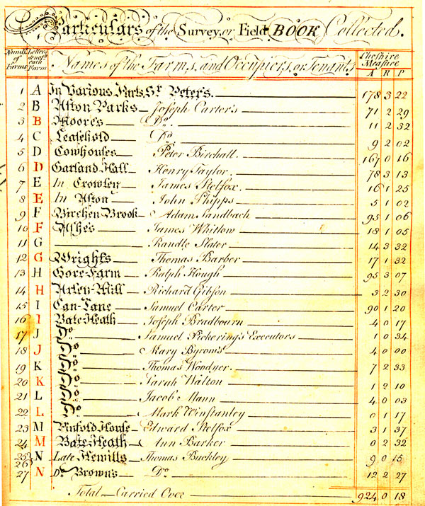
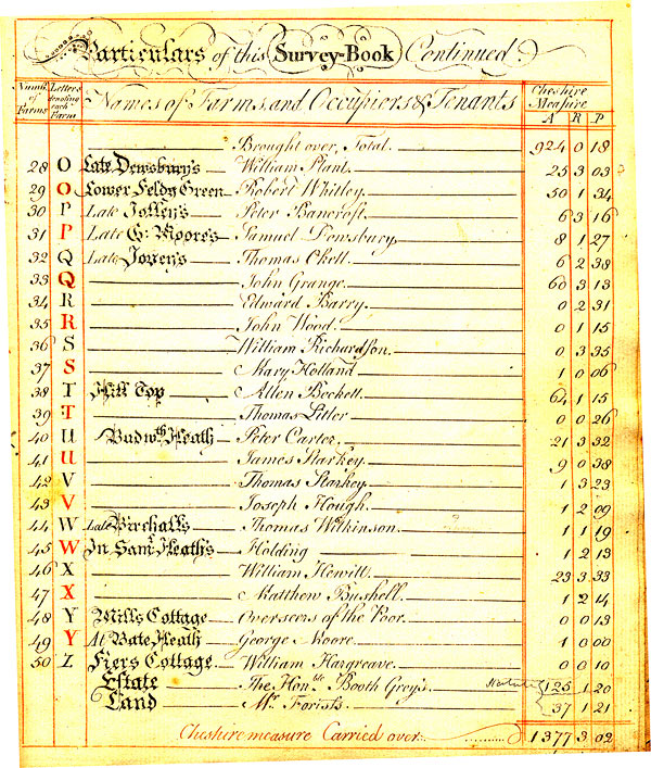
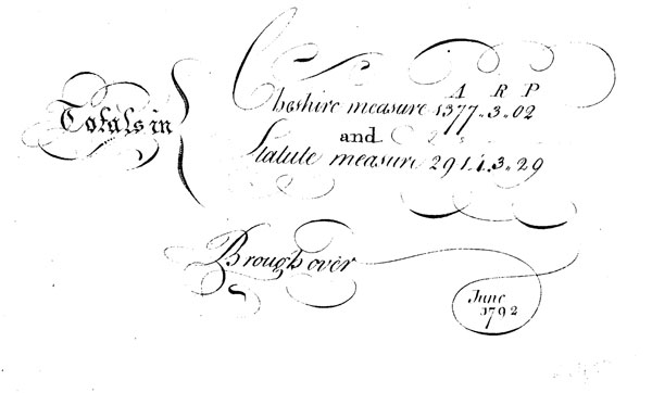
Extracts from the Reference Book to the map of Aston
The pages below are taken from the reference book for the 1786 map above and show farmer's names and acreage, along with the total listed in both Cheshire and Statute measures.